
By Travis Weger, U.S. Forest Service
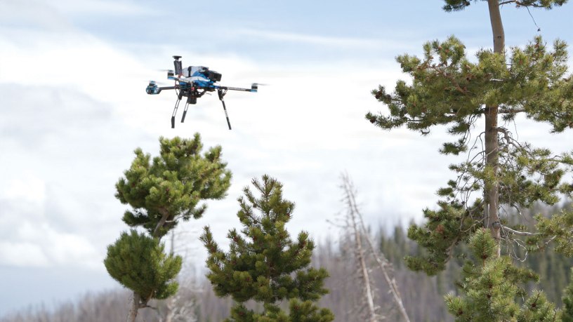
Forest Service pilots lift off an unmanned aircraft system shortly after sunrise, climbing above a burned area from the Cameron Peak Fire in the Arapaho and Roosevelt National Forests & Pawnee National Grassland. From the ground, blackened trunks and downed timber dominate the view. From the air, large pockets of green from new growth become visible.
The Cameron Peak Fire started mid-August 2020 and burned through December of that year, scorching just over 200,000 acres in northern Colorado, which was the largest fire in Colorado history. Six years later, the Forest Service is using drones and artificial intelligence to measure how much of that land is coming back on its own, and where crews may still need to intervene.
“What we’re trying to do is better understand and measure natural seedling regeneration,” said Dr. Bill Monahan, a biological statistician with Forest Health Protection. “We use the data to determine if there is enough natural regeneration occurring, so we don’t need to do more intensive ground-based surveys and plantings.”
A single flight collects thousands of overlapping images. Those images are processed into a three-dimensional representation of the landscape through a technique called photogrammetry, which is then used to generate a geographically accurate, high-resolution image called an orthomosaic.
At approximately 1.5-centimeter resolution, the orthomosaic can identify individual seedlings. Most satellite systems cannot get close to that level of detail, but it becomes the foundation for training the AI model.
A typical unmanned aerial system or UAS flight like this is capable of covering about 50 acres, but for a burn area that is measured in the hundreds of thousands of acres, that reach has limits. That gap is where satellite imagery enters the process.
“We use UAS imagery to create an inventory of the seedlings in an area,” Monahan said. “And then we use that imagery as training data in a machine learning model. That’s what allows us to take our seedling model from the UAS imagery and relate it to satellite imagery with the machine learning model to expand it out over a much larger area.”
The Forest Service accesses commercial satellite imagery through agreements with the U.S. Geological Survey. Timing is critical, both the drone and satellite imagery must be collected before seasonal green-up, when the conifers and lodgepole pine seedlings being tracked are still distinguishable from the surrounding vegetation. Monahan said that if they do UAS work in the spring they can more easily differentiate the seedlings from everything else growing around them.
Typically, assessments rely on field-based plot measurements, crews walking the terrain and counting seedlings by hand. That method remains in use, but it comes with constraints.
A big challenge is covering a large area that is harder to access,” Monahan said. “Using UAS is a huge cost savings in more challenging terrain.”
Perry Nolan, UAS pilot and remote sensing data specialist, sees the safety case just as clearly. In a burned landscape, that means navigating steep slopes and dead trees.
“Flying the drone, you’re not out there in the woods, climbing up the steep slopes, tripping over the deadfall and dealing with snags and everything else,” Nolan said.
The preparation for a mission is methodical and efficient. Nolan described the process of preflight planning, which includes charging equipment, loading base maps, confirming flight objectives and following the notification protocols within the aviation community to ensure the mission is done efficiently and safely.
“Active forest management requires a lot of data,” Nolan said, “and drones are great for collecting massive amounts of that data.”
The maps created serve as a screening tool to identify where there is strong natural regeneration, and where field crews need to plant trees.
For Monahan, the scale of the challenge is what drives the need for a smarter approach.
“We’re never going to fly it all with UAS,” he said. “We need to be creative and think about how we can bridge these different sources of data and technologies, utilizing improved models through AI to generate the types of accurate models and predictions that are needed for decision making.”
Within the Cameron Peak Fire area, that understanding is still developing as more flights are completed and machine learning models are refined, as well as completing additional reforestation efforts. The questions being asked are not new, but the tools being used to answer them are.

